

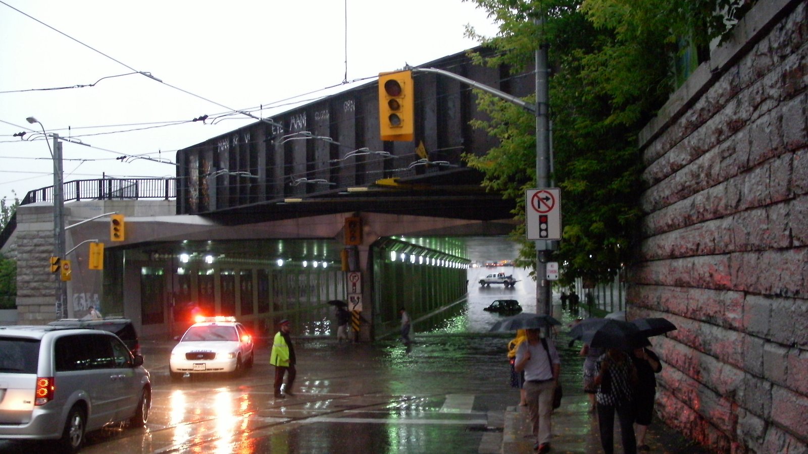
The storm that moved across Toronto on Wednesday afternoon has been classified by the city as a 100-year storm, after more than 110 millimetres of rain fell on parts of the city in a matter of hours.
It arrived around 3:30 p.m. and did not clear until roughly 8 p.m. In that window it closed the Don Valley Parkway in both directions, knocked out power to 65,000 Toronto Hydro customers, and generated close to 1,500 calls to Toronto Fire Services.
What the storm did
Hail fell across parts of the city, described by observers as ranging from ping-pong ball to golf ball sized. Winds were strong enough to bring down trees and power lines, which is what caused most of the outages.
The road closures were extensive at the peak:
- Don Valley Parkway, both directions
- Gardiner Expressway eastbound at Jarvis
- Lake Shore Boulevard West, Strachan to British Columbia Road
- Allen Road southbound at Lawrence
- Sections of the Bayview Avenue Extension
- The Highway 404 southbound on-ramp at Steeles in Markham
The TTC lost service between Wilson and Sheppard West, closed Line 6 Finch West because of debris on the tracks, and ran shuttle buses to fill the gaps. Trains were not stopping at St. Patrick station, and northbound service was held at Union.
Six people were evacuated from a North York building after a roof collapsed. No injuries were reported there, and no deaths have been attributed to the storm.
Where things stand
By Friday, about 2,500 Toronto Hydro customers were still without power, down from 65,000 at the peak. One North York building housing 600 residents went 38 hours before its power came back.
“We absolutely appreciate the hardship it imposes and we appreciate the patience of our customers,” Toronto Hydro spokesperson Dan Smart said, adding that crews are working around the clock until everyone is restored.
Mayor Olivia Chow said city divisions and agencies were working together to monitor conditions through the storm.
TTC chief executive Mandeep S. Lali said in a statement that “keeping Toronto moving safely during extreme weather takes planning, teamwork and exceptional dedication,” crediting staff who adjusted service and cleared infrastructure during the event. Service was running as scheduled across the network by Thursday.
Why it hit so hard
CP24 meteorologist Bill Coulter attributed the intensity to a tropical air mass over the city meeting a cold front pushing down from the north. “The cold front pushed the warm, moist air quickly up to cooler layers of the atmosphere where it rapidly condensed and built into towering cumulus clouds,” he said, calling the result one for the history books.
Retired Environment and Climate Change Canada climatologist David Phillips made a broader point about the label itself. “We’re seeing 100-year storms don’t take 100 years to come,” he said. “We’re seeing like a dozen in 100 years.”
Tornado watches were issued for parts of southwestern Ontario during the same system, and a possible tornado was reported near Wellesley. Environment Canada had not confirmed a tornado in Toronto.
Sources: CP24, CBC News, Toronto Hydro, Toronto Transit Commission, September 2 to 4, 2026.